|
| View from North Downs Way near Ranmore Common |
This is another walk in the Box Hill area, with the same starting point as
last year's walk to Box Hill, but exploring the west side of the Mole valley. In the description below, grid references were obtained from
UK Grid Reference Finder and the points can all be displayed
here.
Starting at Box Hill and Westhumble station, turn left and head up the hill over the railway bridge, bearing left onto Chapel Lane. Just after Pilgrims Way turn left onto a footpath at TQ 16517 51855 [B].
Follow this, crossing one road along the way, eventually reaching a kissing gate into a field. There's a second gate immediately ahead, pass through this to meet the North Downs Way at TQ 16358 51446 [C].
 |
| Joining the North Downs Way |
Turn
right on to the North Downs Way, and follow this all the way to Ranmore
Common. Along the way, there are good views of Denbies Vineyard to the
left, initially with the Mole Valley and Box Hill beyond, and then as
the path bears to the right and emerges from the trees, Dorking and
Westcott.
 |
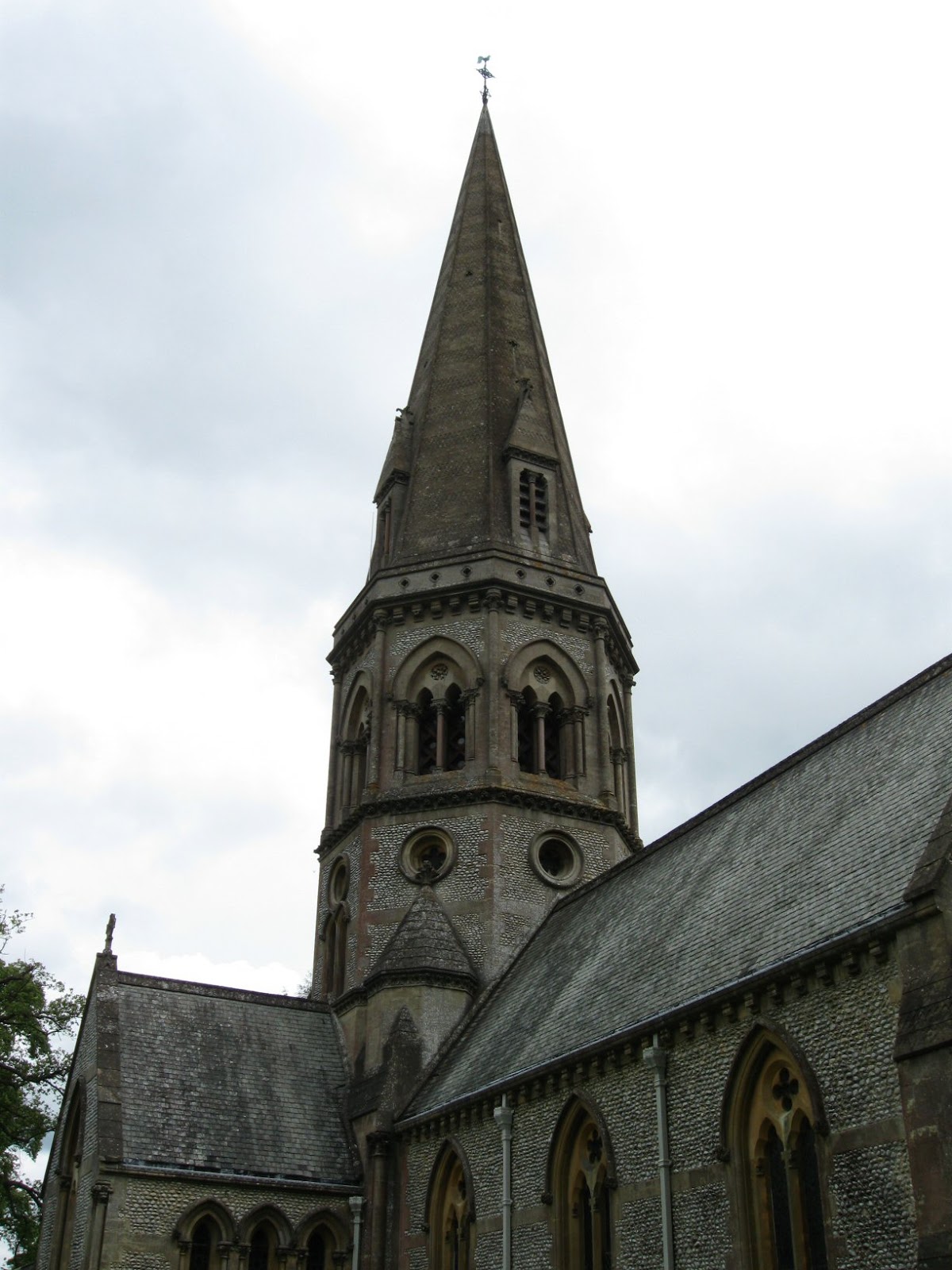
| Church of St Barnabas |
The surface is easy walking for most of the way, and soon becomes a tarmac road - watch out for the Denbies Vineyard tour "train", pulled by a Land Rover.
Follow the North Downs Way as it turns right at TQ 15124 50529 [D] and left at TQ 15091 50691 [E] on to Ranmore Common Road. Follow this, and if time permits spend a while looking at the Church of St Barnabas on the left.
Ranmore Common Road emerges from the trees at a junction at TQ 14355 50369 [F], the North Downs Way continues on the other side of the road - look for the footpath post immediately opposite.
Follow the path around to the right, and then straight ahead into the trees. There are further good views of the valley over to the left.
 |
| Ranmore Common |
Immediately after the gate at the Forestry Commission sign at TQ 13991 50275 [G], take the footpath backwards and to the right, which soon bears left and leads back out to the road. Cross the road and head left, a footpath post is visible on the right hand side at TQ 13897 50458 [H].
There are in fact three paths leading away from here, this walk takes the middle one, signposted for the Youth Hostel at Tanner's Hatch. At the Youth Hostel, follow the path round to the right at TQ 14009 51552 [I].
Soon after emerging from the trees, there is a junction of paths at TQ 14423 51730 [J]. At this point, it is possible to branch off and visit Polesden Lacey, see the note below for this extension.
Bear right across open land to Bagden Farm, and then left to meet Chapel Lane at TQ 14802 52093 [K]. From here, follow Chapel Lane back towards Westhumble. Note that the lane is winding and narrow, and
difficult in places, but it is nevertheless possible to walk straight back into Westhumble this way.
Alternatively, take a right turn on to Ranmore Common Road, and then take the footpath off to the left at TQ 15246 51946 [L], following this upwards and keeping to the left - the footpath continues across a style and alongside the edge of the trees. Cross another style and then follow the path as it bears to the right.
At the footpath junction at TQ 15871 51622 [M] turn left, and then look for the footpath on the right at TQ 16028 51856 [N]. Rejoin Chapel Lane, and follow it back into Westhumble.
 |
| Italianate Bridge |
For the extension to Polesden Lacey (allow a minimum of one hour for this), instead of bearing right across the open land at TQ 14423 51730 [J], follow the path ahead and round to the left, heading uphill to the Italianate Bridge at TQ 14309 51974 [O]. Use the steps just beyond the bridge to the right hand side to reach the road and head towards the house and grounds.
Note that it is possible to enter the grounds from this road, by following it to the gate and entering at TQ 14209 51964 [P], but it is possible to access the visitor centre and facilities without buying a ticket for the house and grounds, there is a gate to the right at TQ 14248 51952 [Q] before reaching the boundary gate. Keep following this path around the boundary, through two gates at TQ 14067 52280 [R], bear left around the edge of the trees at TQ 13950 52481 [S] before finally meeting the entrance road at TQ 13699 52384 [T].
From there, the main entrance is ahead and on the left.
To rejoin the walk, head back to the Italianate Bridge, and continue on the road, which winds down to Bagden Farm. Pass through the gate to the left of the main gate and on to Chapel Lane.
 Last year I enjoyed spending some "December down time" rummaging through Picasa albums in search of 2011's best bits, so this year I thought I'd do it all over again.